5 of the hardest hiking trails in Georgia
Are you an experienced hiker looking for something more than flat ground and easy walks? Are you looking for an intense workout with changing landscapes? If so, here are some of the most difficult hiking trails in Georgia for you to check out.
The Appalachian Approach Trail
If you’re looking for a longer hike for the weekend, consider traveling up to Amicalola State Park where your hike will take you to Springer Mountain. A round trip of 17.8 miles, this hike may take you up to nine hours to complete. You’ll walk by Georgia’s tallest waterfall in Amicalola, through forests and mountains, and across ranging elevations.
Location: 418 Amicalola Falls Road, Dawsonville; Website: amicalolafallslodge.com; Contact: 706-344-1500
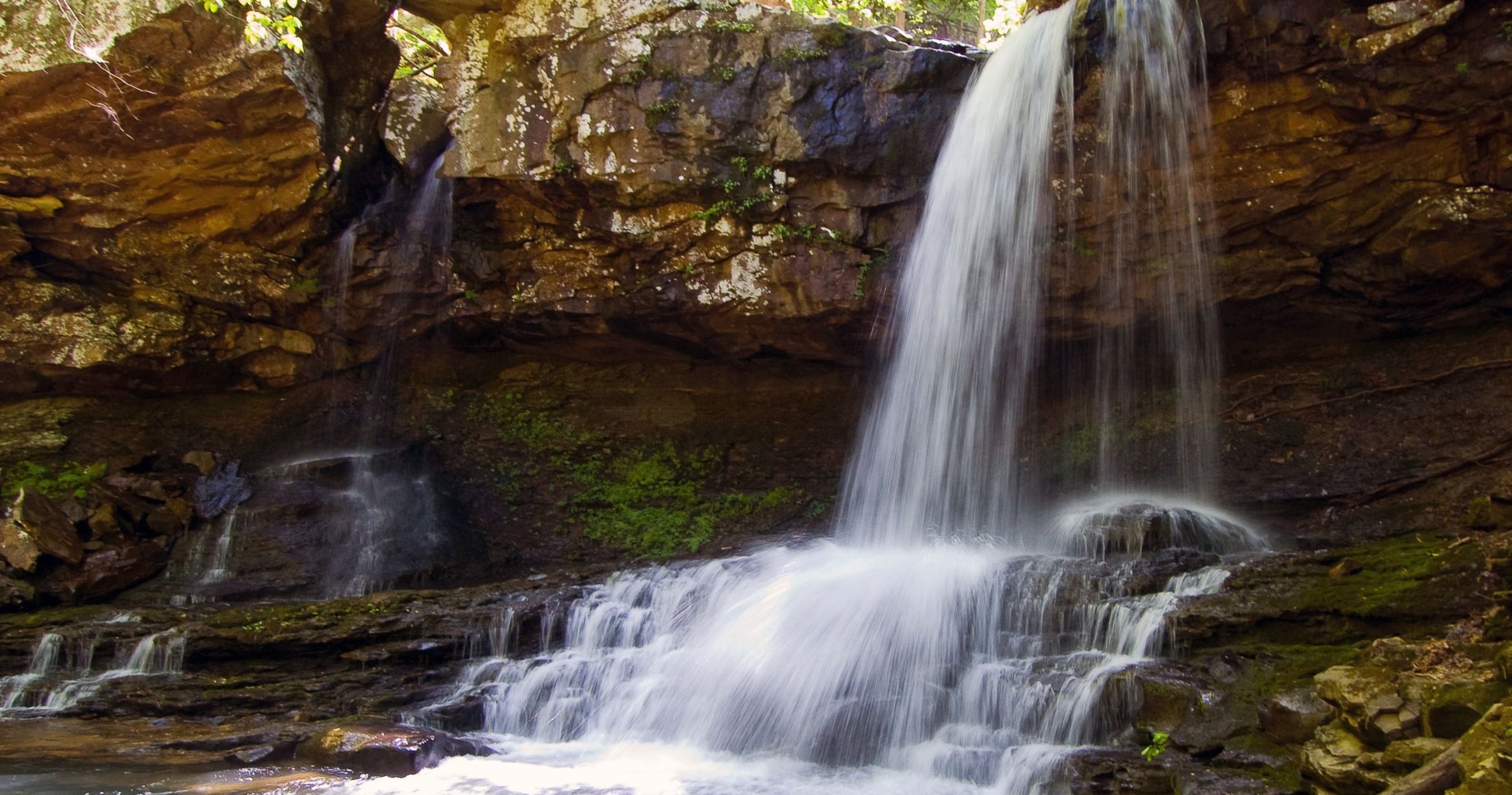
Cloudland Canyons Waterfalls Trail
Spend a day trip hiking at Cloudland Canyons where the challenging trails make the hike all the more rewarding. The Waterfalls Trail is just 2 miles long; however, it involves a lot of stairs and intense drops in elevation to take you by the waterfalls. The trail begins at the rim and descends into the waterfalls where you’ll find breathtaking views from start to finish.
Location: 122 Cloudland Canyon Park Road, Rising Fawn; Website: gastateparks.org/CloudlandCanyon; Contact: 706-657-4050
Yonah Mountain Trail
The Yonah Mountain trail takes up to four hours to complete and is 2.2 miles long for a 4.4-mile round trip. This uphill climb reaches an elevation of over 3,000 feet, giving your calves a great workout. While the strenuous hike will give you a challenge, the views at the top of the mountain make the strain worth it.
Location: 1900 Chambers Road, Cleveland; Website: Yonah Mountain Trail
Blood Mountain and Freeman Loop Trail
Visit the highest point on the Appalachian Trail at Blood Mountain. This 6-mile hike will take you up to nearly 4,500 feet in elevation. On your steep climb, you’ll pass by streams, boulders and a beautiful outlook at the summit.
Location: 405 Vogel State Park Road, Blairsville; Website: gastateparks.org/Vogel; Contact: 706-745-2628
Conasauga River Trail North
In Cohutta Wilderness near the border between Tennessee and Georgia, Conasauga River Trail is a 13-mile hike. You’ll pass through river crossings, white water rapids and forests. While the hike itself is challenging, the remoteness of the trail adds an extra level of difficulty. Navigation may be tough, so make sure you grab a handheld GPS or map to take with you.
Location: 2694 Old Hwy 2, Cisco; Website: Conasauga River Trail North; Contact: 706-695-6736